Most reserves, zones and land uses from the current Town Planning Scheme No. 40 are carried across into draft Local Planning Scheme No. 42, with the structure of both Schemes being generally the same. Consistent with the Local Planning Strategy, some key changes included in draft Local Planning Scheme No. 42 are:
Introduction of ‘urban corridors’ along Albany Highway and Manning Road. These corridors include densities of R80 and R60 and some R100 in the vicinity of Albany and Leach Highways, and are intended to allow more intensive development in close proximity to good public transport infrastructure.
A marginal increase in density from the current R30 to R40 in parts of Bentley, St James and Wilson (north of Leach Highway) that are outside the Albany highway and Manning Road urban corridors. A multi-criteria analysis identified redevelopment potential in these areas, and an R40 density is considered to facilitate redevelopment of aging properties.
Introduction of an ‘urban corridor’ along Leach Highway from Webb Street to High Road, and along High Road, Willetton (between Leach Highway and Willeri Drive). This corridor increases the density of Residential-zoned properties to R40 (from R20 and R25), again to allow more intensive development close to public transport infrastructure connecting into Bull Creek Station.
A change in zoning for the Willetton Industrial Area from the existing Mixed Business zone to Light Industry (with the exception of properties between High Road and Roxby Lane, which will retain a Commercial zoning). Due to an underlying Metropolitan Region Scheme ‘Industrial’ zone, the City is restricted to applying an industrial zone to this area. Light Industry is considered the most appropriate zone based on existing land uses and the need to adequately manage impacts with surrounding Residential-zoned properties.
A density of R40 to Residential-zoned properties surrounding Riverton, Southlands and Livingston District Centres. This allows a marginal increase in intensity for developments close to these District-level commercial centres.
To view Draft Local Planning Scheme No. 42 text click here and the .pdf maps click here. You can view the draft Local Planning Scheme No. 42 Maps online on the Draft LPS 42 IntraMaps online mapping portal accessible through the link https://bit.ly/2wvyNLN. Instructions to for using the online mapping portal are available here.
Please read the Frequently Asked Questions (FAQ's) on the right (Downloadable pdf available here) . If you have any further queries not on the list, please contact Strategic Planning on 1300 422 664.
Decision to review Town Planning Scheme No. 40 - November 2016
Draft Local Planning Scheme No. 42 has finished this stage
At the Meeting of 17 May 2016, Council resolved to review TPS 40 and 9 Guided Development Schemes. The WAPC approved this review in November 2016.
Local Planning Scheme No. 42 Adopted - July 2017
Draft Local Planning Scheme No. 42 has finished this stage
At the Ordinary Council Meeting of 20 July 2017, council resolved to adopt new draft Local Planning Scheme No. 42 and forwarded it the Environmental Protection Agency and WAPC for review and certification of advertising.
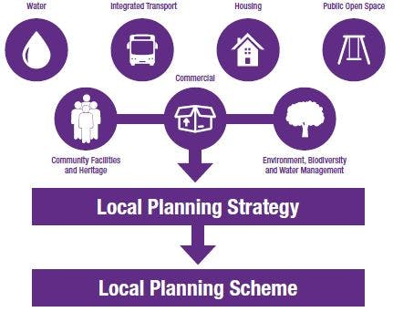
Local Planning Strategy - October 2017
Draft Local Planning Scheme No. 42 has finished this stage
The Local Planning Strategy is a key strategic urban land use document. It provides the basis for zoning and other requirements in the Local Planning Scheme. The Strategy was prepared through extensive engagement and was approved 24 October 2017 by the WAPC.
Consultation
Draft Local Planning Scheme No. 42 has finished this stage
This consultation is open for contributions.
Review of contributions & review of draft LPS. 42
Draft Local Planning Scheme No. 42 is currently at this stage
Gazettal of new Local Planning Scheme No. 42
this is an upcoming stage for Draft Local Planning Scheme No. 42